


Due to its location between Denver and Colorado Springs, Castle Rock is home to a large population of commuters. Despite significant municipal growth, as many as 80 percent of residents regularly commute out of town for work, with an average commute of nearly 29 minutes.
As part of the larger Denver-Aurora-Lakewood, CO metropolitan statistical area, much of that commuting time involves driving on roads that make up important freight transportation corridors with significant commercial vehicle traffic.
This extended exposure to commercial vehicle traffic on highways and interstates puts Castle Rock commuters at risk of being involved in a trucking collision at some point. From 2021 – 2024, nearly 2,000 people were injured in over 8,000 collisions involving a large truck in Douglas County and the surrounding counties of Arapahoe, Denver, El Paso, Jefferson, and Teller. These collisions are most common on major interstates and U.S. highways, such as I-25, I-70, and US 85 – but the transportation network in the area makes up thousands of miles of roadway.
Which areas are Castle Rock commuters at the highest risk of being hit by a commercial truck? Casares Injury Law examined four years of Colorado collision data to find out. We isolated crashes that involved a medium or heavy truck (anything from a box truck to a fully loaded tractor-trailer and everything in between)that occurred on an Interstate, US Highway, or State Highway in the aforementioned counties.
We identified 15 three-mile-long road stretches where at least 60 truck crashes occurred. Below are the areas of local roads with the risk of trucking collisions.
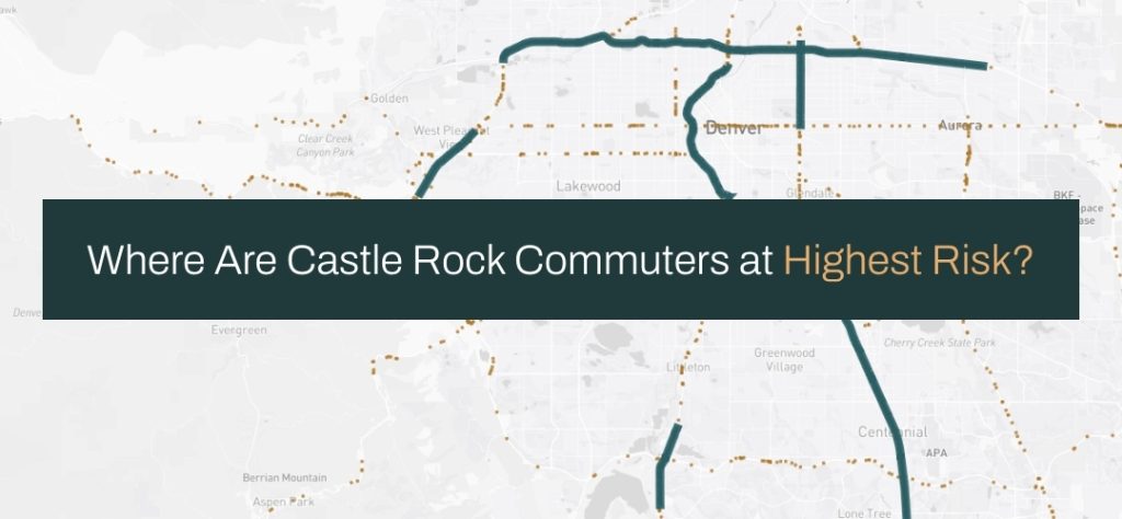
[Interactive Map] Truck Crashes and High Collision Road Segments
The map below is interactive. Hover over each stretch or collision point to reveal more information about each. If viewing on a mobile device, rotate the device for the best viewing experience. Pinch and zoom or use the mouse wheel to zoom in and out and view crashes and stretches in Colorado Springs.
Table: A Closer Look at the 15 Most Dangerous Stretches
This table provides the full list of high collision stretches along with the start and end points and the number of injuries and fatalities that occurred there during the observation period.
| Rank | Road Name | Crashes | Injuries | Deaths | Start | End |
|---|---|---|---|---|---|---|
| 1 | I-70 | 196 | 39 | 0 | I-25 | Dahlia St |
| 2 | I-70 | 139 | 51 | 2 | Forest St | Central Park Blvd |
| 3 | I-70 | 125 | 37 | 2 | Havana St | I-225 intersection |
| 4 | I-25 | 124 | 35 | 0 | I-70 | West Colfax Ave |
| 5 | I-25 | 106 | 26 | 0 | West Colfax Ave | South Broadway |
| 6 | I-70 | 104 | 21 | 3 | CO-58 | Carr St |
| 7 | Colorado Blvd | 98 | 14 | 0 | I-70 | East Colfax Ave |
| 8 | I-70 | 81 | 25 | 0 | Lowell Blvd | I-25 |
| 9 | US Hwy 85 | 75 | 17 | 0 | West Mineral Ave | West Highlands Ranch Pkwy |
| 10 | I-25 | 70 | 26 | 0 | East County Line Rd | RidgeGate Pkwy |
| 11 | I-25 | 68 | 24 | 2 | South of East Hampden Ave | East Orchard Rd |
| 12 | I-70 | 68 | 15 | 2 | Carr St | Osceola St |
| 13 | I-70 | 62 | 26 | 0 | intersection with 90 | Indiana Street |
| 14 | US Hwy 85 | 62 | 25 | 0 | Just North of Bijou St | South Nevada Ave |
| 15 | I-25 | 60 | 6 | 1 | East Orchard Rd | E County Line Rd |
All but one of the highway stretches were found in the greater Denver area, with only one stretch – a section of Highway 85 – located in Colorado Springs. Similarly, I-70 and I-25 dominate the list, making up 12 of the 15 high collision segments that we identified.
With nearly 200 trucking collisions during the study period, the three-mile stretch of I-70 from the interchange with I-25 to Dahlia Street is the most dangerous place for motorists in the region.
However, three consecutive stretches of I-25 may pose the most consistent risk to the largest number of commuters. These three stretches cover a total of nine miles from Ridgegate Parkway to East Hampden Avenue. Anyone commuting to Denver Tech Center or traveling anywhere north on I-25 will likely travel through this area.
Commonalities in Truck-Involved Crashes in the Region
While a trucking collision can occur anywhere at any time, they are most likely to occur mid-block or in a roadway rather than at an intersection. In fact, 65 percent of truck crashes occurred in areas marked as non-intersections, while only 17 percent occurred at intersections. The remaining 18 percent were either intersection-related or ramp-related.
In most cases, collisions involving large trucks involve two or more vehicles traveling in the same direction. Sideswipe and rear-end crashes are most common, accounting for 75 percent of all truck-related crashes in the region (45 percent and 30 percent, respectively).
Driver behavior plays a significant role in most motor vehicle crashes and those involving trucks are no different. When a truck driver’s behavior was noted to be a contributing factor in a crash, lane violations, careless driving, and following to closely were the most commonly cited. It is important to note that this data field is not a violation field and may not always be properly noted or recorded. It can, however, help motorists understand how trucks can cause crashes and what behavior to be aware of.
Data and Methodology
This study is based on motor vehicle collision data from the Colorado Department of Transportation for the years 2021-2024. We used road data from the US Census TIGER/LINE program to identify three-mile stretches where a high volume of truck crashes occur. We isolated crashes involving medium or heavy trucks with a Gross Vehicle Weight Rating of 10,001 and above.
If you would like to share or report on our findings please provide a link back to this study to give readers additional context.